Designed by geologists, SMART4D uses a 3D model and connection to real-time data, to create a proactive geosteering workflow. SMART4D is a technological advantage for operations teams, allowing users to visualize wells in both 2D and 3D, communicate through online reporting, and update models in real-time.
Interpret - Visualize - Communicate - Enhance

Client Testimonial
The success of our recently finished drilling program was due to a number of factors, one of which was Smart 4D. The biggest benefit was the geosteering capability which gave me the improved ability to give directions to the rig on targets and the ease and quickness of communication to all team members is outstanding. The program allowed me the confidence to remain in zone even when I was away from my computer.
I also like the fact we have created a static geomodel for the first time and that it can be updated as we drill. All structural tops and isopachs get updated on the fly and are added to the geomodel in real time. The program is fairly simple and straightforward to learn and use and unlike some of the more complex programs out there I spend less “busy” time navigating the program and more time interpreting the data.
Altura Energy
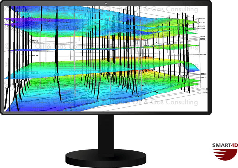
SMART4D Geosteering Software provides a start to finish reservoir modeling and analysis tool that incorporates all available geological and geophysical data into a clean, easy to use, multifaceted display. The software also contains quality control tools for geostatistical mapping and characterization.
Using 3D mapping and visualizations, our interactive software allows:
- Spatial geostatistical mapping
- Create 3D maps for reservoir characterization
- Petrophysical characterization and visualization
- Flexible horizontal panels to analyze your wells and reservoirs
The 3D models created in SMART4D use automated data collected through WITSML. The software successfully combines the real time geology interpretation changes while-drilling, leveraging directional driller tools and sensors to provide an optimal well placement solution in a 3D environment.
Give SMART4D a Try!
Our user friendly software will exceed your expectations! Contact us to learn more about how SMART4D can assist you! We also offer 1 month free trials so that you can geosteer a well and see how it will work for you.