Automated emailing features, including alarms and reports allow for easy distribution of information to users. Email reports can be populated with the user’s choice of data. During the geosteering process, this data is pulled directly from the live WITSML feed to ensure the data reported is up to date. To enhance reports, additional comments, PDFs and images can be attached to emails.
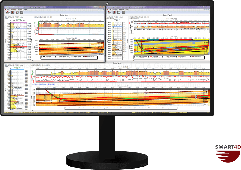
Geosteering Features
Geosteering is the process of adjusting well placement while-drilling to improve overall well performance. StratCORR, Dynamic Profile, Target Planner, and other features are some the geosteering software features setting SMART4D apart.
Using the features of our Geosteering Software has proven to reduce drilling time, reduce dog-leg severity and increase well length in zone.