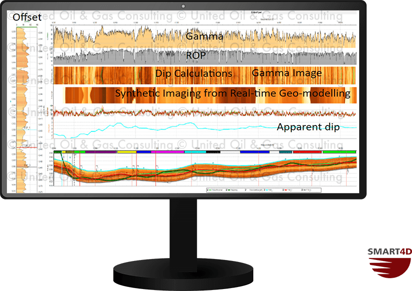
Create wellbore imaging using azimuthal gamma and resistivity tools (2, 4, 8, 16 or 32 tracks) with the SMART4D Geosteering Panels. In the wellbore image you can see the smiles and frowns, as well as the contrasts in the wellbore, to calculate dip. Geosteering with a well-bore image in real-time while-drilling using data acquired through WITSML or static import. Furthermore, using SMART4D Geosteering Software you can develop a synthetic wellbore image of Gamma, Resistivity, Porosity or other 3D property models improving interpretations for geosteering or modelling.
Geosteering Features
Geosteering is the process of adjusting well placement while-drilling to improve overall well performance. StratCORR, Dynamic Profile, Target Planner, and other features are some the geosteering software features setting SMART4D apart.
Using the features of our Geosteering Software has proven to reduce drilling time, reduce dog-leg severity and increase well length in zone.