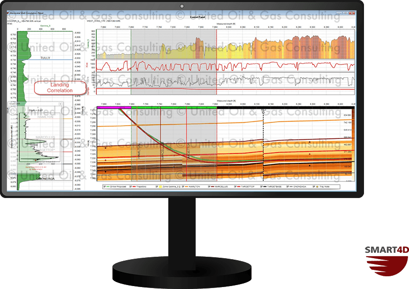
StratCORR will allow you to make dynamic stratigraphic correlations, enhancing your reservoir understanding while drilling. Use StratCORR to calculate apparent dip, adjust structures and isopachs and improve your current interpretation of your target formation. Interpretation points created by StratCORR participate in 3D modelling, which may result in structural changes. By having an increased understanding of where you are and what is ahead of the bit, users can be more confident in decisions on where to go next.
StratCORR has the ability to recall saved correlations for reinterpretation and information retention. Correlations can be made using multiple reference offset wells, and the recalled correlations will adjust to the appropriate reference well. Easy access to historical information helps you get the best well placement, and increases your knowledge-base for future wells.