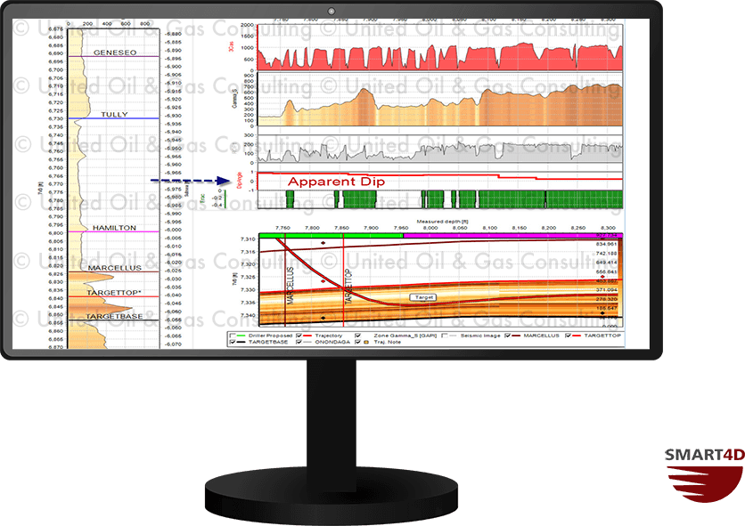
The prognosis for the apparent dip of the target formation is automatically calculated along the length of the driller’s plan well prior to drilling. This gives the user a realistic pre-drill understanding of the formation. Once drilling begins and the model is adjusted, the apparent dip is continuously updated both along the actual trajectory and ahead of the bit, helping the geosteerer proactively adjust upcoming decisions on well placement.
Geosteering Features
Geosteering is the process of adjusting well placement while-drilling to improve overall well performance. StratCORR, Dynamic Profile, Target Planner, and other features are some the geosteering software features setting SMART4D apart.
Using the features of our Geosteering Software has proven to reduce drilling time, reduce dog-leg severity and increase well length in zone.