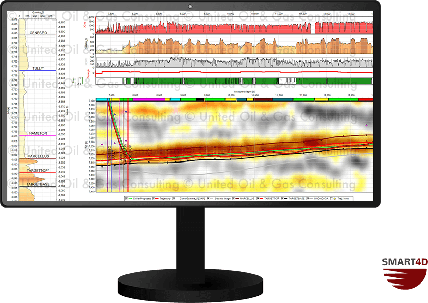
The 3D seismic underlay tool positions a seismic section along the horizontal well path using georeferencing. While finalizing driller’s plans within SMART4D, the seismic underlay adds insight into the proper well placement. During drilling, the seismic image can be used in conjunction with the property model to ensure the well is within the target zone.
- Simple georeferencing to position.
- Assist with well planning.
- Guide for geosteering within target zone.