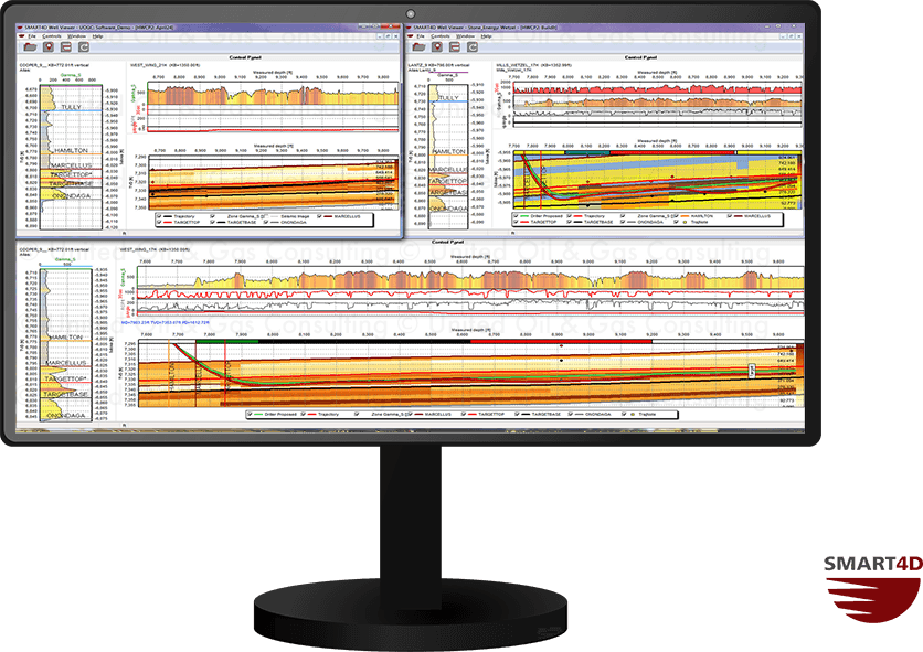
The Well Viewer allows users to monitor multiple horizontal wells simultaneously in a network environment. The geosteering tools including Dynamic Profile and StratCORR are available for users to make interpretations on the incoming data.

  • View multiple horizontal wells.
  • Monitor live WITSML data.
  • Interpret using geosteering tools.

Geosteering Features

Geosteering is the process of adjusting well placement while-drilling to improve overall well performance. StratCORR, Dynamic Profile, Target Planner, and other features are some the geosteering software features setting SMART4D apart.

Using the features of our Geosteering Software has proven to reduce drilling time, reduce dog-leg severity and increase well length in zone.